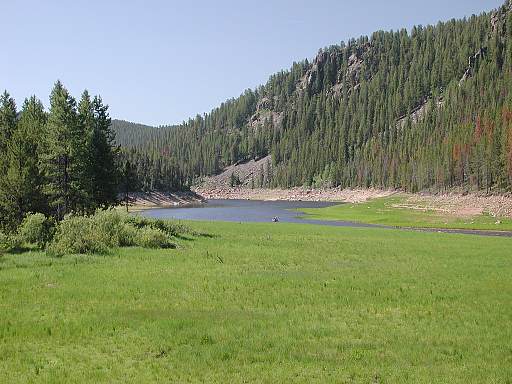
Click on photo to walk a short ways ahead to Columbine Creek.
The water level of Lake Granby rises and falls dramatically with
snowmelt and as water is artificially pumped up to Shadow Mountain
Lake. From there it flows by gravity to Grand Lake and then through a 13
mile tunnel under the Continental Divide to heavy water users on the Eastern
Plains who have registered "water rights" or "shares" of the Big Thompson
Project. 230,000 acre-feet of water is diverted through this tunnel on
average each year (enough water to flood 360 square miles of land
one foot deep) ... all that from precious snowfields of sort you'll soon
be shown. The valley shown here is periodically flooded and drained
according to these human "calls" for water (as much as 550 cubic feet
of water per second). This valley is now the upper reach of "Grand Bay".
The "dot" in the photo where the River meets the Bay is a boat that has
come up from Lake Granby.